Opened in 1975, Kings Dominion has offered millions of guests a wide variety of rides, attractions, shows, and menu options. The Kings Dominion historical maps tell part of the story of how the property changed over the years. The following maps are either from our own collection or gathered from around the internet. Any photos that are not our own are copyright to their respective owners including Paramount or Kings Dominion/Cedar Fair.
Note: The CPFoodBlog and associated partners noted below have spent countless hours tracking down older digital versions of maps from archives and/or scanning in paper copies. If you use one of the maps listed, please credit and link to the CPFoodBlog and owners listed.
If you have a historical map not listed that you would like to have linked up or added, please message us.
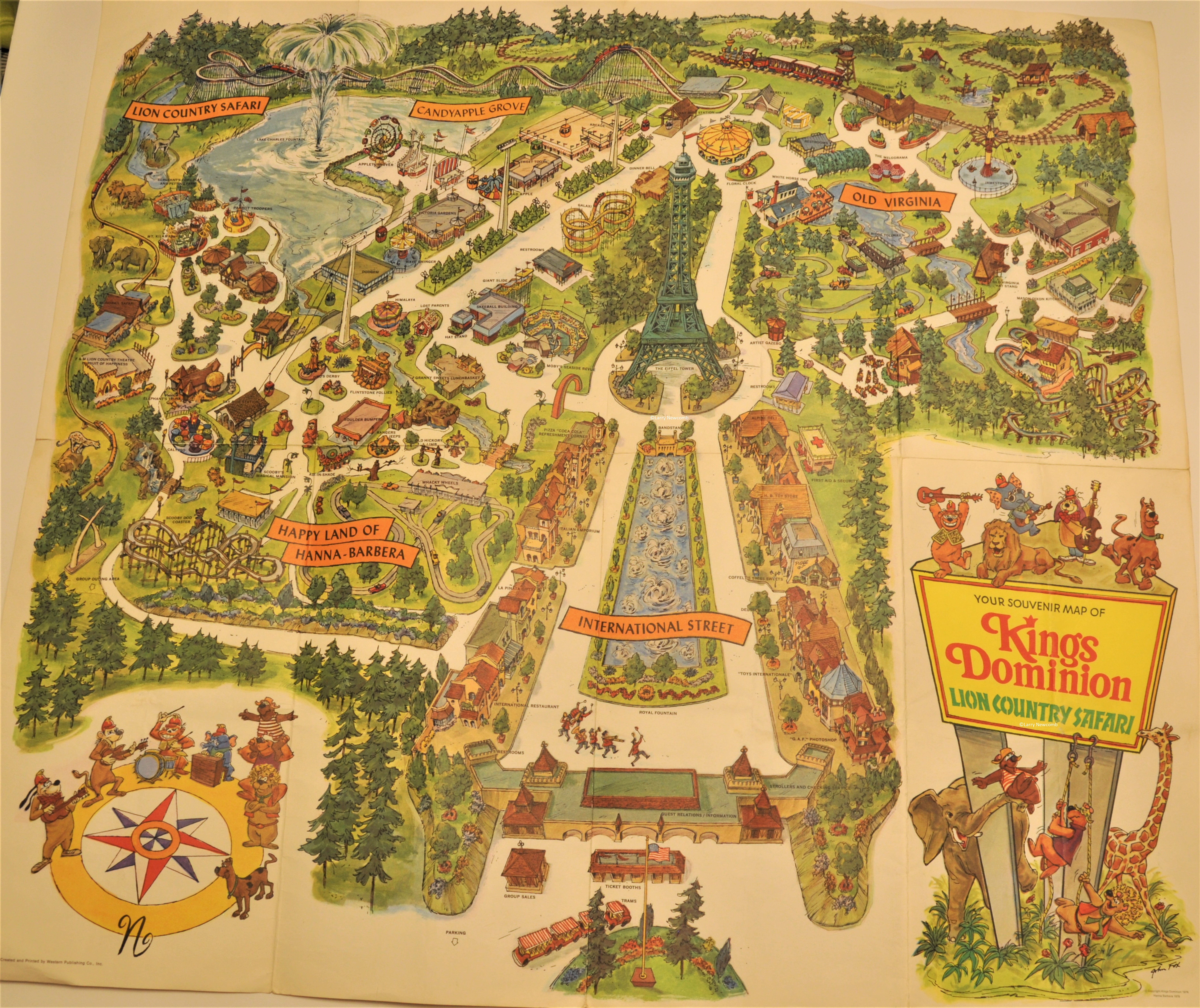
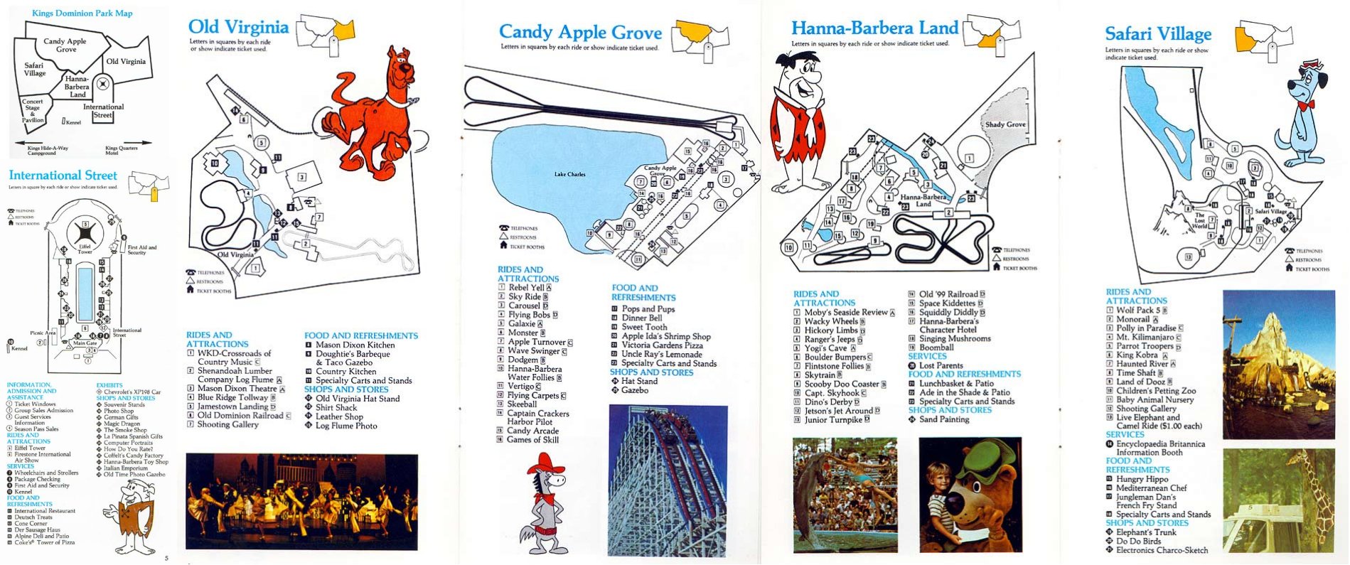
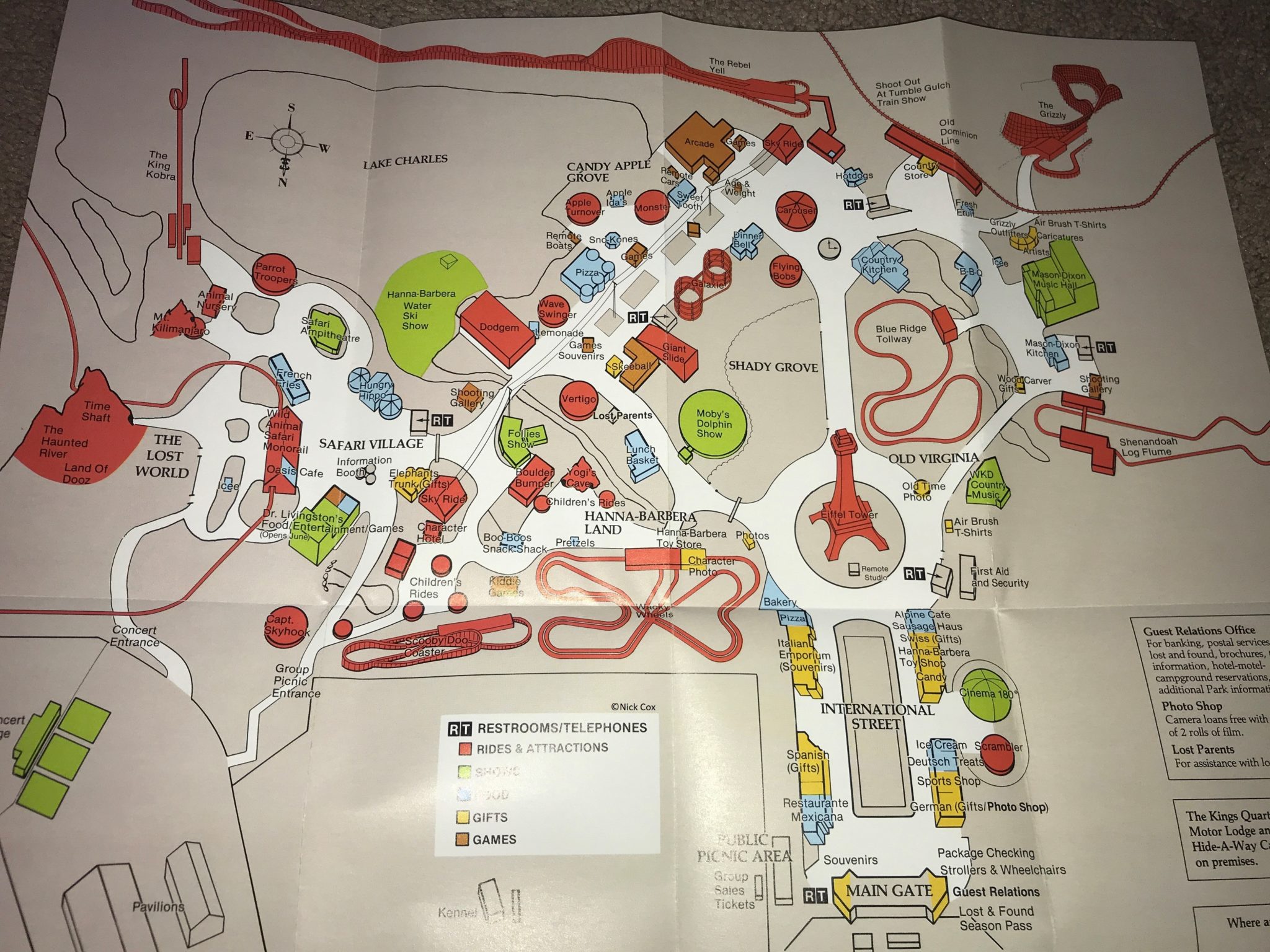
Kings Dominion Historical Maps
1996 Kings Dominion Guide & Map ©Frank Forrester
2000 Kings Dominion Map ©Beth C.
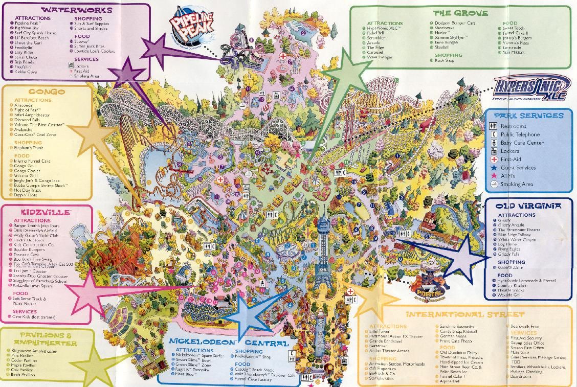
2002 Paramount’s Kings Dominion Map
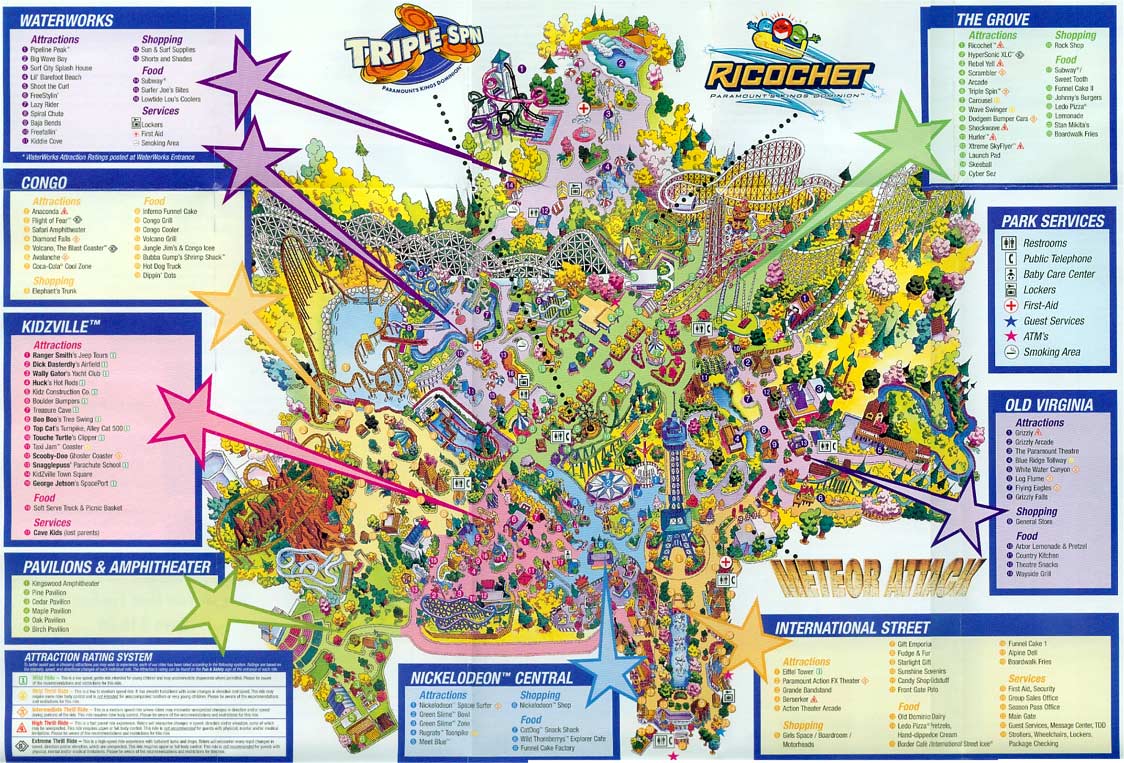
2003 Paramount’s Kings Dominion Map
2004 Paramount’s Kings Dominion Map
2005 Paramount’s Kings Dominion Map
2006 Paramount’s Kings Dominion Map
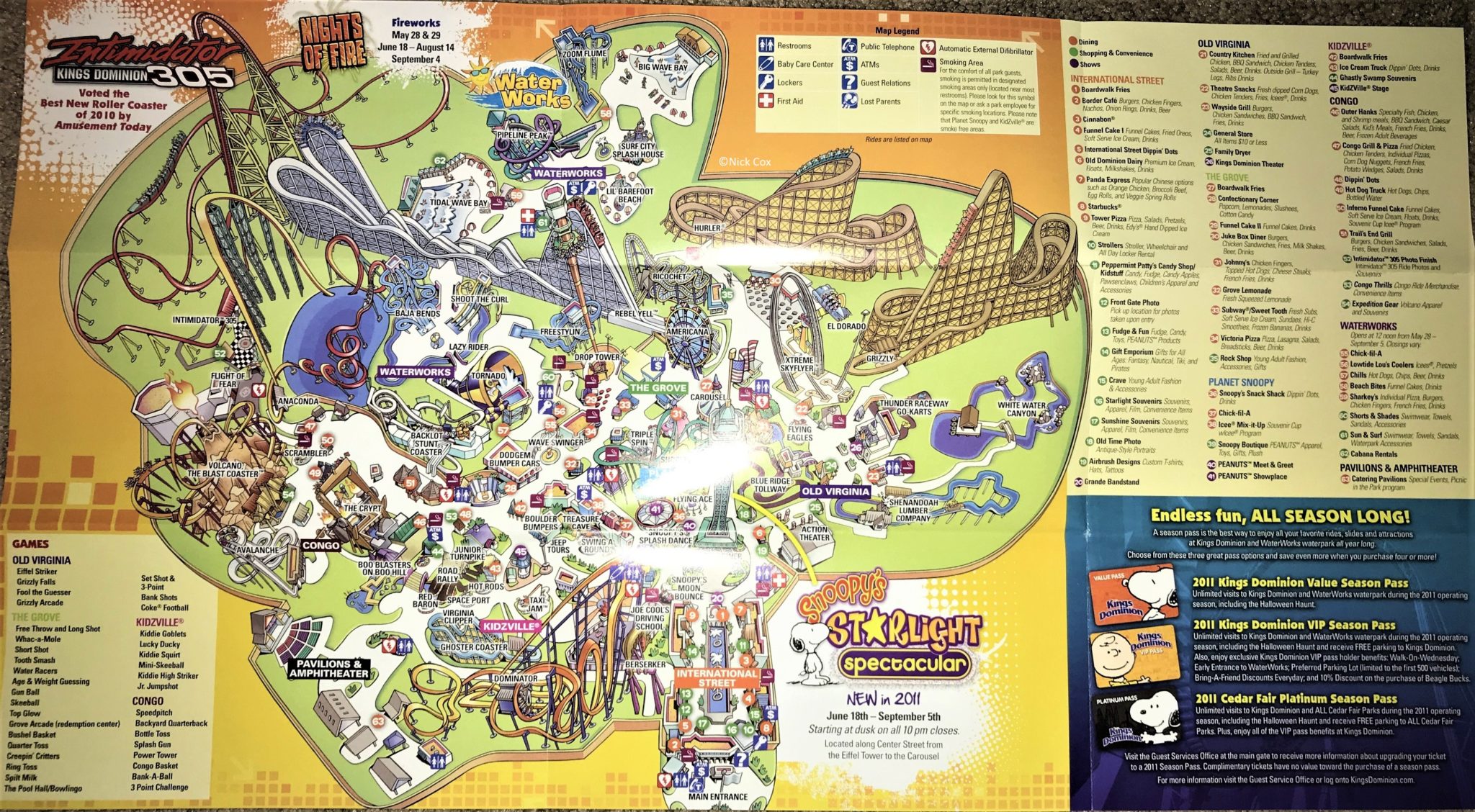
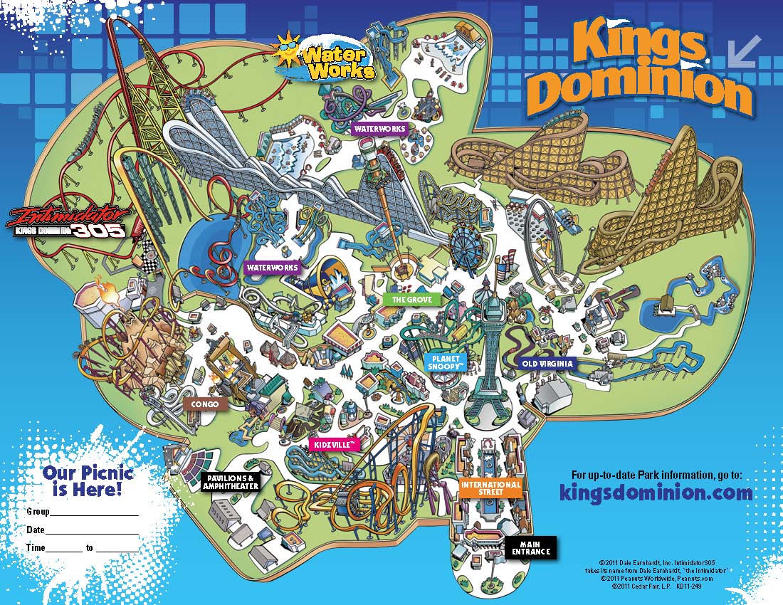
2011 Kings Dominion Picnic Map
2014 Kings Dominion Park Map & Guide
2018 Kings Dominion Winterfest Map
What was your favorite map year? If you have a historical map that you would like to share, please contact us for all to enjoy.


